Last updated
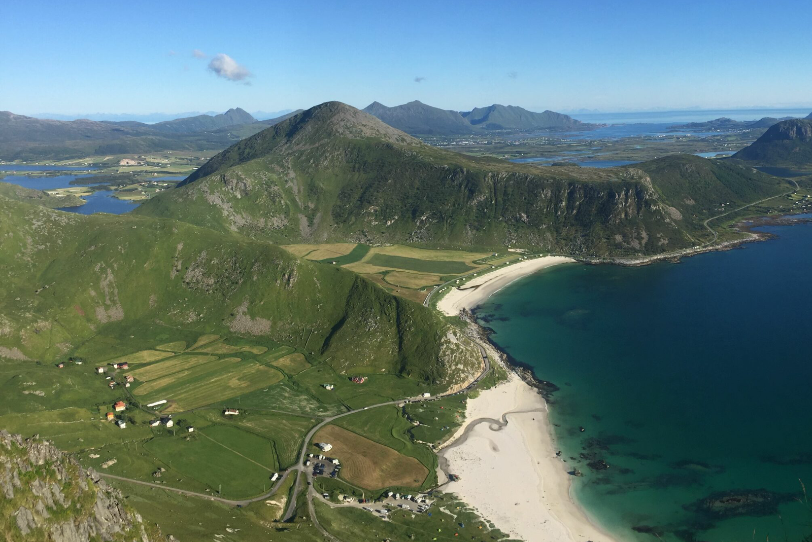
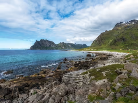
Mannen is a 400-metre peak on Vestvågøy that overlooks the white sand of Haukland Beach. The hike takes two to three hours round trip and starts from the beach parking lot, following a road for about 500 metres before the trail turns uphill. You climb a ridge that gradually reveals the full sweep of the coastline below: turquoise water, white sand, and jagged peaks stretching out in every direction. The contrast between the alpine terrain you're standing on and the almost tropical-looking beaches below is hard to process.
The trail is straightforward but not gentle. The lower section is a mud pit. Even in dry spells the ground stays saturated, and after rain it becomes a slippery mess that will ruin anything short of proper waterproof hiking boots. Bring trekking poles as you'll want them on the descent, when gravity and wet clay are working against your knees.
As you gain elevation the mud gives way to rockier ground and the ridge opens up. The middle section is the easiest stretch, wide enough to feel comfortable, with views expanding with every step. You can see Haukland Beach curving below and the rocky headland that separates it from Uttakleiv Beach to the north.
The final push to the summit gets steep and exposed. There are drop-offs on both sides of the ridge that will bother anyone with a sensitivity to heights. This is not a roped-off tourist path. You're on a mountain. If high winds are forecast, skip the hike for today. The exposed upper ridge becomes dangerous in strong gusts, and Lofoten weather shifts fast. Check the forecast right before you leave.
Low clouds will completely erase the view from the top. If the summit is socked in, you're climbing for nothing. On a clear day the panorama stretches across the entire Vestvågøy coastline, with Haukland and Vik beaches to the south and Uttakleiv to the north. On a cloudy day you're standing in a grey void wondering why you got muddy. Monitor conditions closely and be willing to postpone.
Timing and crowds
Peak hiking season runs May through September. July and August afternoons are the worst for crowds. The ridge is narrow enough that congestion becomes a real issue when dozens of people are trying to pass each other near the top. The parking lot fills up fast during these hours too.
If you're visiting during the midnight sun period (late May to mid-July at this latitude), you can hike late in the evening. Start at 9 or 10 PM when the light is warmer and lower, the trail empties out, and you get the summit largely to yourself.
Parking and access
The trailhead sits at the Haukland Beach parking lot, about 15 minutes by car from Leknes. Parking is paid. The lot fills up quickly on summer afternoons. If it's full, try the Uttakleiv side, which adds some distance to the hike but at least you're not circling a packed lot. Public restrooms are available at the Haukland parking area.
A summer-only bus (line 765) runs from Leknes to Haukland twice daily between late June and late August, but the schedule is limited enough that you should plan on having a car.
Extending the day
A gravel coastal path connects Haukland Beach and Uttakleiv Beach at sea level, following an old road that was used before the tunnel was built. It's flat, easy, and gives you a completely different perspective on the same landscape. Budget 45 minutes to an hour each way. If one person in your group doesn't want to do the summit, this is a good alternative. The two of you can split up and meet back at the car.
Highlights
Best time to go
Time needed
Getting there
What to do nearby