Last updated
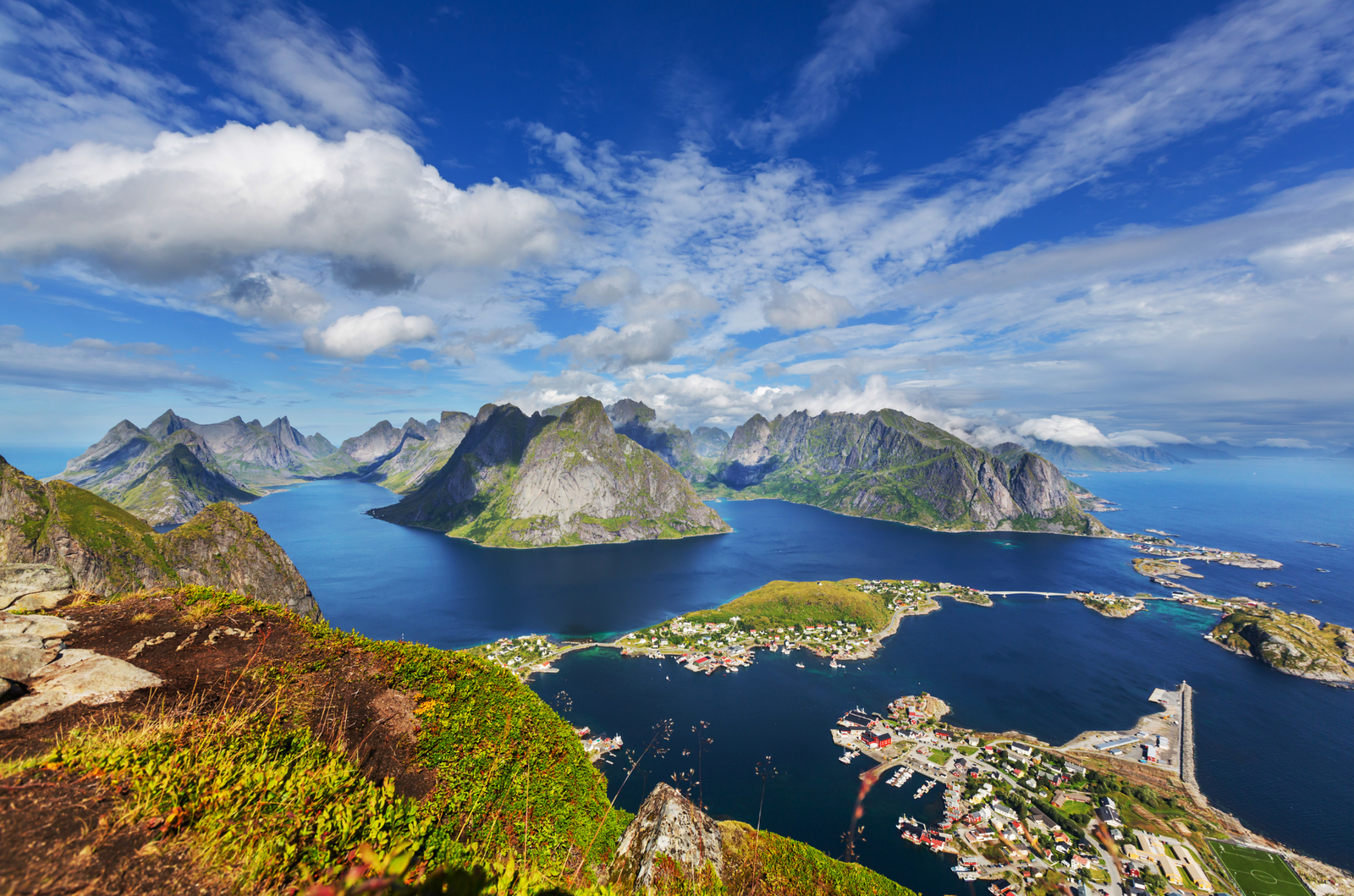
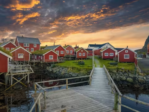
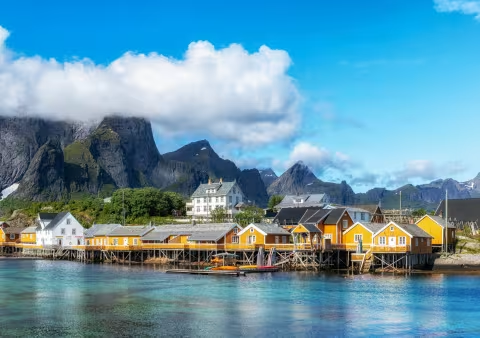
Reinebringen is a steep coastal mountain above Reine village in Lofoten. Nearly 2,000 stone steps, built by Nepalese Sherpas between 2016 and 2021, carry you from sea level to a summit ridge overlooking Reinefjorden. The view from the top is the postcard image of Lofoten: the fishing villages of Reine, Sakrisøy, and Hamnøy connected by slender bridges over deep blue water, ringed by granite peaks that drop straight into the Vestfjord.
If clouds are sitting low or fog is rolling in, skip it. The climb is steep and continuous, not an experience in itself, the only reason to do it is the view. On an overcast day you're rewarded with sore legs and a view of grey nothing from a narrow, windswept ridge. Wait for a clear window, even if it means rearranging your schedule. Lofoten weather shifts fast, and a bad morning can turn into a perfect evening.
The trail itself is almost entirely stone staircase. No scrambling, no route-finding, no technical gear. Just lots of stairs. Your calves will burn within the first fifteen minutes and your knees will remind you of every step on the way down. Walking poles will be useful here.
The summit ridge is narrow and has no safety barriers. When it's crowded, and it will be on any sunny afternoon between June and August, you're sharing that narrow space with dozens of people jockeying for photo positions. It can feel precarious. Rain makes the stone steps slick and the ridge section muddier, dry conditions is important.
Timing and crowds
Peak congestion hits between roughly 10:00 and 16:00 in summer. The staircase is narrow enough that passing slower hikers requires patience and sometimes awkward shuffling. During the midnight sun period, roughly mid-May through mid-July, hiking late in the evening works well. You get softer, warmer light for photography and a fraction of the foot traffic. Starting at 21:00 or later puts you at the top in near-empty conditions while the sun hangs low over the sea.
The hiking season runs roughly mid-May to late September. Outside that window the mountain is covered in ice and snow with serious avalanche risk. Winter ascends are not recommended. If you're not sure about conditions at the edges of the season, check the Reinebringen Facebook page before you go.
Getting to the trailhead
There is no parking at the trailhead itself. Don't try to squeeze onto the E10 highway shoulder. You'll get a 900 NOK ticket. Park in one of the designated areas: the Djupfjord/Steffenakken viewpoint lot (free, about 1.3 km south of the trailhead), the paid municipal lot in Reine's outer harbour (Ytre Havn), or the Reine Kultursenter lot. All of them mean a 15 to 25 minute walk before you even start climbing.
Stay at Reine and you will be able to walk to the trailhead from your accommodation.
From any of these, follow the E10 towards the Ramsvik tunnel. Do not walk through the tunnel. It's dark, narrow, and cars come through fast. Take the old road that curves around the outside instead. The trailhead is clearly marked along this stretch, right where the stone steps begin. The detour adds maybe ten minutes.
Use the public restrooms in Reine before you start. There are no toilet facilities at the trailhead or anywhere on the mountain.
What to bring and expect
Round trip takes about 2 hours depending on your pace and how long you linger at the top, plus whatever the walk from parking adds. Sturdy hiking shoes with good grip are non-negotiable on the stone steps. Trail runners work fine if they have aggressive tread. Sandals and fashion sneakers are a recipe for a twisted ankle or worse.
The summit is noticeably colder and windier than Reine down below. Bring a windproof layer even if it feels warm at sea level. The hike is free.
The view from the summit is one of the broadest coastal panoramas in Norway. The fjord, the bridges linking the islands, the colour contrast between dark granite and turquoise water. On a clear day it delivers everything the photos promise.
Alternatives to Reinebringen
Ryten (543m) sits about 30 minutes north of Reine near Fredvang and looks down over Kvalvika Beach from a cliff edge that's become one of Lofoten's most photographed spots. The trail is longer (roughly 7 km round trip, three to five hours) but the gradient is more forgiving than Reinebringen's relentless staircase, with boggy meadows and gentle ridgeline walking before a steeper final push.
Offersøykammen (436m) is a different proposition. It's on Vestvågøy near Leknes, about an hour's drive from Reine, and much less popular than Reinebringen or Ryten. The hike is short (under 3 km round trip, two hours or so) and steep from the start, but there's no exposed ridge at the top, just a broad summit with an unobstructed 360-degree view over the Nappstraumen strait, Haukland Beach, and a sprawl of islands. If you want the big Lofoten panorama without the crowds or the vertigo, Offersøykammen is the one.
Highlights
Best time to go
Time needed
Getting there
Hotels nearby