Last updated


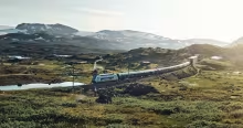
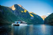
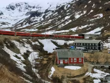


Everyone tells you to do Norway in a Nutshell. The Nærøyfjord is one of the most spectacular fjord crossings in the country, and the Flåm Railway deserves its reputation for the views on the descent from Myrdal. The catch is volume. Flåm is a cruise ship port, and in July the railway runs near capacity with tour groups filling the carriages. The 2-day version of the route spreads the journey over an overnight in Flåm, which thins out the crowds and lets you actually stop and look at things.
The alternative is driving south from Bergen into the Hardangerfjord. Less famous, less crowded, and the road along the fjord from Norheimsund to Odda is one of the best drives in the country.
Explore the locations


What you're looking at
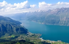
The Hardangerfjord stretches 179 kilometres inland from the Atlantic to the edge of the Hardangervidda plateau, making it Norway's second-longest fjord. People call it the Orchard of Norway. Cistercian monks brought fruit cultivation here in the 13th century, and today the shores support hundreds of thousands of apple, plum, pear, and cherry trees. The region's cider was the first Norwegian alcohol to receive a Protected Geographical Indication, which places it in the same legal category as Champagne.
The landscape doesn't look like the Sognefjord corridor at all. Where the Nærøyfjord (Norway in a Nutshell route) gives you vertical granite walls and dramatic narrows, Hardangerfjord has orchards on steep hillsides, snowcapped peaks reflected in wide water, and villages that exist because people live and farm there. The mountains block the worst North Sea weather while the deep fjord water stores heat, and together they produce conditions good enough to grow fruit at 60 degrees north.
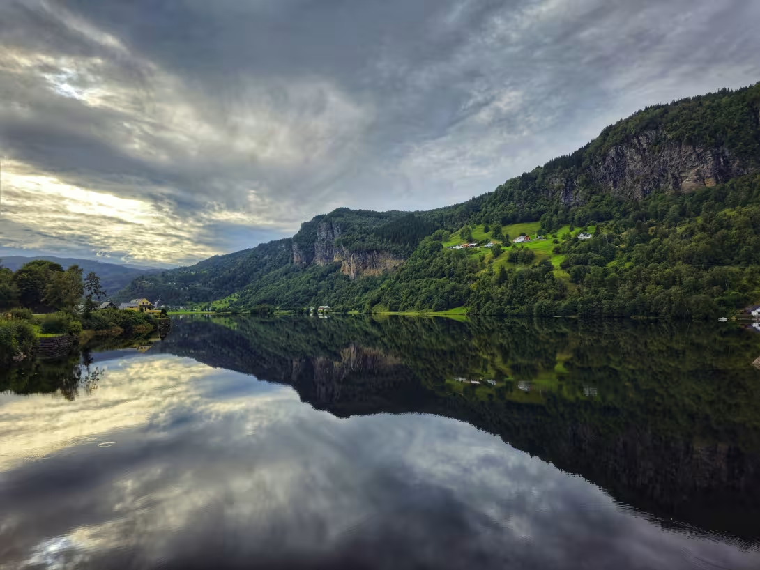
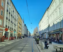
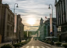
Norheimsund in the Hardangerfjord
Day trip or overnight
You can do Hardangerfjord as a day trip from Bergen, but you'll miss the best of it.
Travel North runs highly rated day trips from Bergen to the Hardangerfjord which will let you see some of the highlights without needing a car. The downside: While the tour has several stops throughout Hardanger, the only thing you will see from the scenic road itself is Steindalsfossen.
Driving is often the better option. The local bus network runs infrequently enough that it's not worth building a trip around. Guided tours work if you'd rather not drive, though you lose the ability to linger at a cider farm, reroute when the weather changes, or stop when the light is right.
Ideally, Hardanger is a three-to-five day loop from Bergen, and the length depends on what you want to fit in. Three days covers the driving, cider farms, some activities, and the main scenic stops without a big hike. A fourth day opens up Dronningstien or a full day on the glacier. A fifth puts Trolltunga and the Hardangervidda plateau within reach on the return. Doing everything on this itinerary would require at least five days.
Most of what makes Hardanger worth the trip is along the scenic route itself. It hugs the water through orchards, ducks under hand-built tunnels from the early 1900s, and pauses at architect-designed rest areas built under the Nasjonale Turistveger programme. GPS time estimates will lie to you. Single-lane sections, ferry waits, and the pull-over temptation on every bend push the time above estimates.
When to go
Mid-May for the orchard blossom. The window is short, usually 10 to 14 days, and the Lofthus and Ullensvang hotels book up fast around it. June for peak waterfall flow from snowmelt. July and August for long days, warm weather, and the worst ferry queues and Trolltunga crowds. September is the cider harvest, colder mornings, fewer people, and the producers at their most active.
From November through March, the mountain detours close or get unreliable, some of the rest areas shut, and the Scenic Route itself is mostly empty. Hardangervidda can close in winter storms with no warning.
Getting out of Bergen
Two practical ways, and they commit you to different opening stretches of the Scenic Route.
Option A: Direct to Norheimsund via Fv49
About 80 to 90 minutes. Leave Bergen on E16, turn off at the Trengereid roundabout, and follow Fv49 along Samnangerfjorden down to Norheimsund. This cuts the Granvin-to-Steinsdalsfossen section of the Scenic Route but is faster. Pick this if you want the Norheimsund RIB tour in the morning, or just want to cut down on the driving time.
Option B: Via Voss to Granvin
Granvin is the start of the scenic route, about 2 hours from Bergen. Take th eE16 to Voss, then Rv13 south to Granvin. This will allow you to drive the Scenic Route in full, including the Kvanndal-Tyrvefjøra-Steinstøberget stretch that Option A skips.
The return from Kinsarvik passes through Voss either way.
There is actually a third option as well where you drive through Norheimsund both ways. This will allow you to do the Granvin to Norheimsund stretch on the return journey, completing the whole scenic route.
If approaching via Voss, stop at Skjervsfossen before reaching Granvin. Skjervsfossen consists of twin falls dropping 150 metres. Here you will find toilets with a view to the river below. The road closes in winter.
The north shore: Granvin to Norheimsund
The road is narrow, single-lane in sections, and runs on shelves above the water.
Kvanndal is the first proper rest area south of Granvin, with a toilet block whose roof lighting turns it into a minor evening landmark.
Tyrvefjøra outside Ålvik is the showpiece. The Helen & Hard-designed rest area opened in 2022 has two separate toilets built from local pine trunks under a concrete roof that appears to float above the landscape. The rest area itself, with benches and a small shingle beach, is the reason to stop. Toilets are open early May to late October.
Steinstøberget another nine kilometres on is a more traditional rest area with tiered seating, fjord fishing access, and picnic tables. Worth a few minutes.
Steinsdalsfossen and Norheimsund
Steinsdalsfossen is the waterfall you walk behind. A short path from the car park leads to a wooden platform cut into the rock wall. Flow peaks in May and June during snowmelt. It's signposted off the main road a few kilometres before Norheimsund and takes 20 minutes to experience. Entry is free.
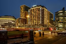
Norheimsund is a working fjord town with a Thon Hotel, a bus terminal, and a harbour. The reason to build a morning around it is the RIB tour.
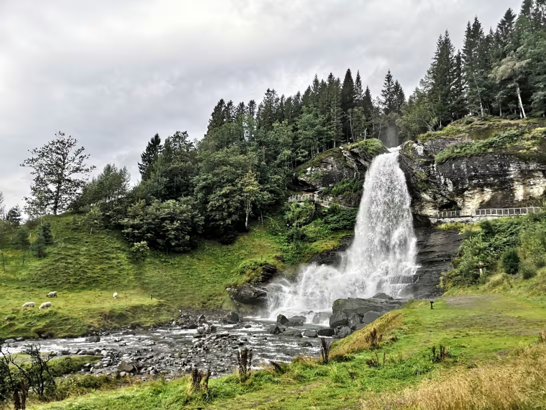
Steindalsfossen - the waterfall you can walk behind
The Hardangerfjord Adventure RIB into Fyksesund
60–75 minutes on the water
Fyksesund is a narrow fjord branch running north off the main Hardangerfjord. No commercial ferry reaches it. A roadless hamlet called Botnen sits at the head, occupied by a handful of families who access it by boat. The cliffs rise straight from the water, in winter the waterfalls freeze into ice sheets, and the stillness on the water is unusual for this stretch of coast. Short of a kayak, a RIB or small boat is the only way in.
Hardangerfjord Adventure runs highly rated small-group tours from the Thon Hotel lobby, meet 15 minutes before departure. Flotation suits, gloves, and goggles provided. Tours run year-round, peak summer books out weeks ahead.
Book the morning departure if you can. Afternoon sea state gets choppier as the day heats up and the wind picks up, and Norheimsund itself is a practical lunch stop after you're off the water.
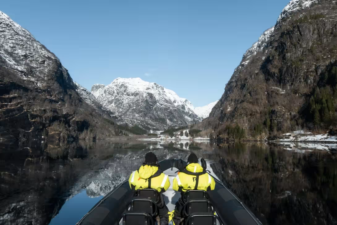
RIB tour in the Hardangerfjord
Crossing the fjord: Tørvikbygd to Jondal
From Norheimsund, drive about 20 minutes south along Fv49 to the Tørvikbygd ferry terminal. The ferry to Jondal runs frequently in summer, around 20 minutes across. No advance booking is required. Weekend afternoons in July and August can queue badly.
Look east on the way over and you'll see the full sweep of the main Hardangerfjord, with the Folgefonna icecap on the peninsula ahead.
Folgefonna glacier detour from Jondal
From Jondal harbour, a 19-kilometre mountain road climbs to 1,450 metres above sea level. The road is a steep hairpin climb that will rattle nervous drivers. At the top sits Folgefonna, a glacier you can walk on. It will take half a day minimum.
Jondal to Utne
Fv550 from Jondal north to Utne is the quietest stretch of the Scenic Route. Fewer cars, more orchards, a handful of small stops worth pulling over for.
Herand village is about ten minutes out of Jondal. Small, mostly working farms, Bronze Age petroglyphs on the rocks above the fjord.
Hereiane rest area another 15 minutes north is the big stop on this stretch. Picnic benches among ice-scoured rocks and pine trees, a designed toilet block with natural stone walls and ceilings, and a short steep hike up to Haugsvarden if you want to stretch. The views back toward Herand justify the break.
Utne is a further 40 minutes from Hereiane, with Hesthamar rest area and a pebble swimming cove halfway if the weather's warm.
Utne: the overnight stop
Utne is a village of around 150 people, walkable end to end in minutes. A small white-timber church sits above the ferry pier. The folk museum is next to the hotel, a few minutes along the water from where the ferry docks. For a 3 day tour this is a perfect place to stay overnight.
Utne Hotel
Historic | Traditional | Quiet
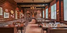
A premium boutique hotel, operating since 1722, it's one of the oldest continuously run timber hotels in Norway. It runs as an old hotel runs: period floors that creak, antique furnishings, no two of the 17 rooms the same, original features throughout. The scale is small enough that staff remember your name by dinner. The restaurant serves local fish and lamb with a real wine list. The whole operation feels closer to a private home than a hotel. Stay here if the evening itself is meant to be part of the trip.
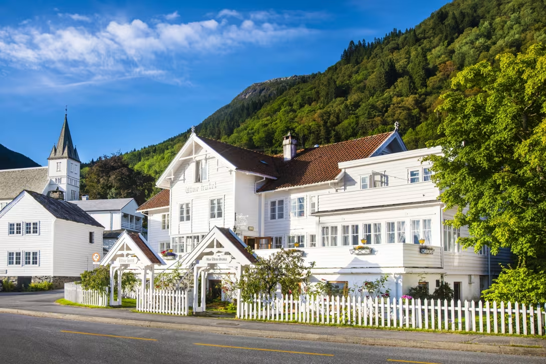
Utne Hotel
Down the western shore: the cider farms
From Utne, drive south on Fv550 along the western shore of Sørfjorden. No ferry crossing needed. You stay on this side all the way down to Odda, with the water on your left and orchards stacked on terraces above you. Four cider producers sit along this stretch, spread across about 45 minutes of driving.
Aga Sideri is the first. Guided farm tours Tuesday to Saturday at 12:00 from late May to early August, award-winning cider, farm shop open Monday to Saturday.
Edel Sider at Åkre Gard is next. Eight generations of fruit farming at the same site, now producing cider, apple juice, and apple spirits under the Edel label. Check åkregard.no for current tour times.
Lunch at Siderhuset Ola K
Siderhuset Ola K at Nå is the best lunch stop on the route. A restored 1912 quayside building that was once the local post office, now a restaurant with the largest local cider selection on the fjord and a weekly-changing menu. The 2-course lunch is the move. Book ahead.
Alde Sider sits on Bleie Farm 15 minutes further south, named Norway's best cider producer in 2018. Tastings Tuesday to Saturday at 12:30 and 15:30 from late May through August, bookable at aldesider.no.
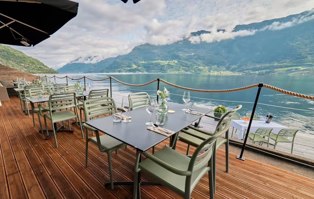
Lunch with a view at Siderhuset Ola K
Låtefossen
Drive further south, past Odda and you will get to the twin falls at Låtefossen. 165 metres, merging just above the old six-arched stone bridge that Rv13 crosses. The bridge itself dates from 1859 and was built specifically to give tourists a close view. You'll get wet walking across it in full flow.
Parking is a small bay next to the falls, tight and often full with tour coaches. Before 10:00 or after 17:00 is when it thins out. If the car park is full on arrival, don't wait around. A small turnout another 200 metres down the road works for a short walk back.
An informal scrambling path leads up the north side of the falls to two upper viewpoints. Unsigned, 15 to 20 minutes return.
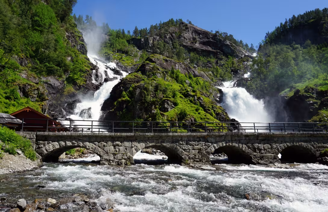
Låtefossen waterfall
Odda
Head back north to Odda, a former smelter town at the head of Sørfjorden. Industrial relics line the waterfront and the old factory buildings still dominate the skyline. The town is the base for Trolltunga, and the access route for Buarbreen, a glacier arm of Folgefonna you can walk to in an afternoon.
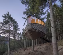
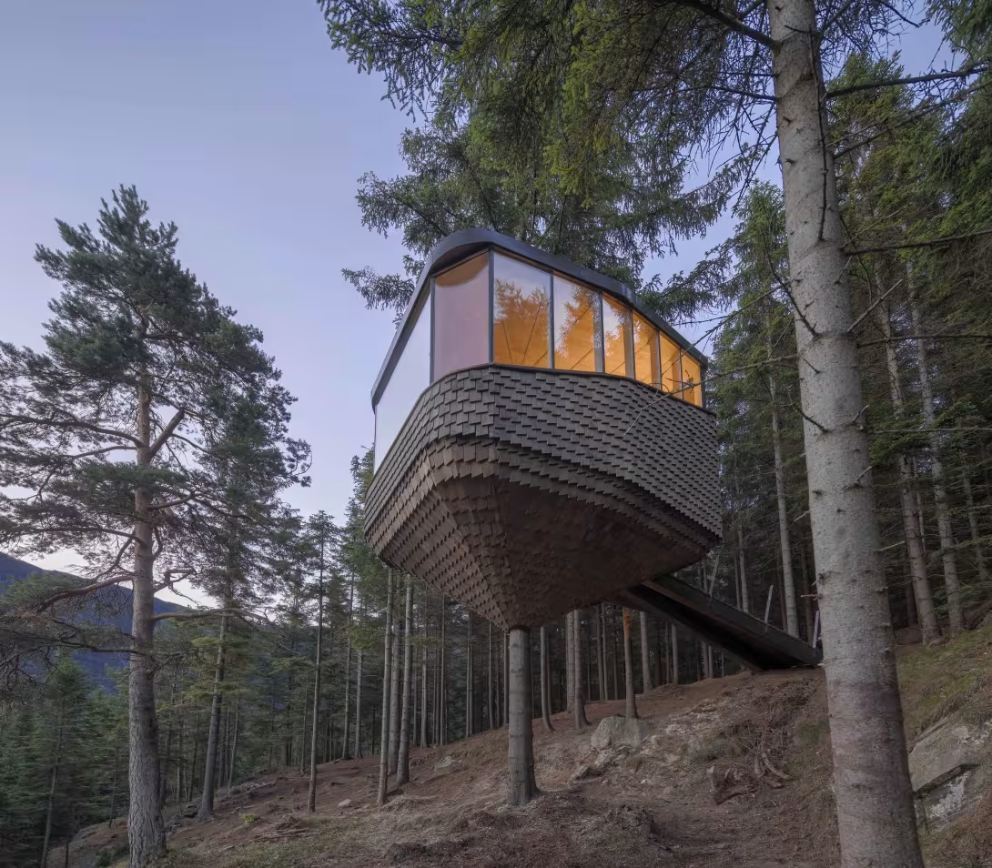
Overnight in the treetops: Woodnest
Architectural | Memorable | Treetop huts
A handful of Helen & Hard-designed timber cabins suspended in the pines above the fjord, by the same architects behind Tyrvefjøra. The walk up from the road is 30 to 45 minutes with your bags, no restaurant on site, so carry dinner and breakfast supplies with you before you arrive. Cabins have a kitchen, a bathroom, and a large window facing the water. One night is plenty for the novelty.
If this is not your thing, there are no other great options in Odda. Instead drive half an hour north on the east side of Sørfjorden to Hotell Ullensvang.
Also, probably skip this if you're hiking Trolltunga the next morning.
Lunch or dinner at Ferskvaren AS
Casual fish counter in central Odda. Fish soup, grilled trout, a display case of local cheeses and cured meats by the door. Eat in or take food out for a picnic on the mountain road. Nothing fancy, but consistently good.
Cabin at Woodnest
Hike Trolltunga
27km round trip from P2 (8–12 hours), 20km from P3, (7–10 hours)
Trolltunga is the photo. You know the image, everyone does, and it's the reason many first-time visitors come to Hardanger at all. What Instagram doesn't show is the distance, the elevation, the weather exposure, or the queue at the rock itself.
Expect 8 to 12 hours on your feet and 700 to 1,200 metres of elevation gain depending on your starting point. On Saturdays in July and August, the photo queue at the rock can run 60 to 90 minutes. It's not technically difficult, no climbing skills needed, but demanding for anyone not used to big mountain hiking.
Go if you're fit, the photograph matters to you, and you've got a full day to commit. June or mid-September weekdays are the best windows: trail is snow-free, the peak crowds haven't arrived, and the weather is stable enough to be reliable. Start before 07:00 whatever the season. If you're short on time or worn from driving, skip it and do Dronningstien instead, which is half the distance, comparable views, and a fraction of the people, but without the tongue.
Anyone hiking it without big-mountain experience should go guided. Self-hiking is permitted 1 June to 30 September. A guide is recommended in the shoulder seasons and effectively compulsory from 1 October to 31 May. Trolltunga Active runs day trips and Trolltunga Adventures runs overnight hikes to Trolltunga. Both are highly regarded local operators.
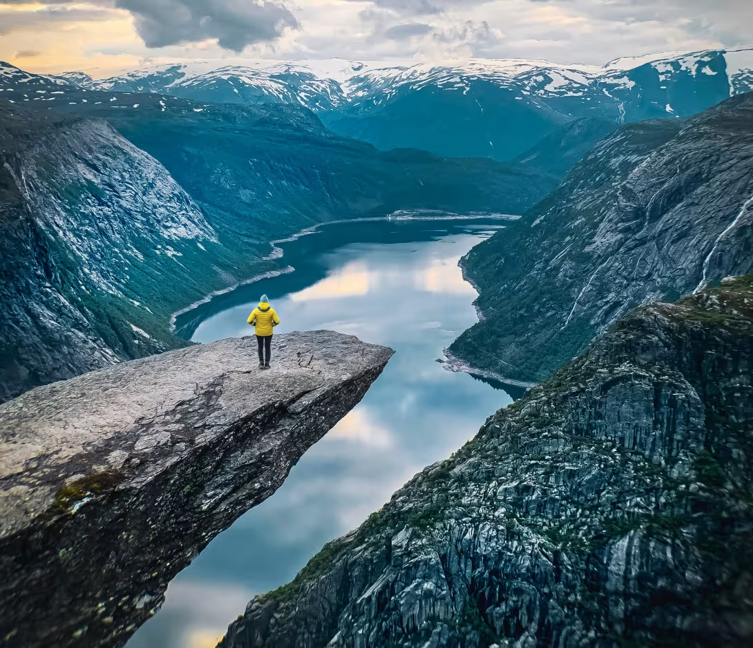
The iconic photo of Trolltunga
North up the eastern shore
From Odda, Rv13 runs north along the eastern side of Sørfjorden through the orchards. This is the side of the fjord with Hotel Ullensvang and most of the accommodation.
Tyssedal, just north of Odda, is the Trolltunga shuttle pickup point. The old Tysso hydropower plant sits here as a monument to early 20th-century industrial ambition, with a small museum if you're into industrial heritage.
Espenes is a designed photo stop roughly 27km north of Odda, with an architectural rest area and a view south across the fjord. Worth five minutes.
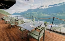
Hotel Ullensvang
Grand fjord hotel | Infinity pools | Orchard setting
Five generations of family ownership at the same site. Indoor and outdoor infinity pools facing the Folgefonna glacier, a spa, orchard trails from the door, and a location that puts you 15 minutes from Dronningstien at Kinsarvik and 25 minutes from Trolltunga at Odda. The rooms in the older wings feel dated. Ask specifically for a fjord-view room in the newer wing. The pool and spa alone justify it as the overnight after a long hiking day. Stay here if you're hiking Dronningstien or Trolltunga the next morning.
Continuing north, Lofthus is a small working fruit village with a Bunnpris supermarket useful for hiking snacks or a picnic before the climb. Kinsarvik another ten minutes further is where Dronningstien starts.
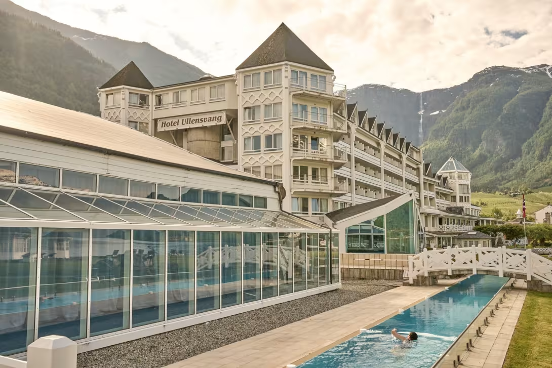
Hotel Ullensvang
Hike Dronningstien
15km, 6 hours, 900m elevation gain
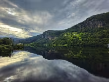
Queen Sonja's panoramic trail, one-way between Kinsarvik and Lofthus. You start at Røte, a small car park 2.5km up a steep narrow road off Rv13 at the Esso petrol station in Kinsarvik, following signs for Dronningstien. From Røte, a gravel road climbs about an hour to Heng at 890 metres where the marked trail begins. From there the path runs the ridge above Sørfjorden for four to five hours, with continuous views of the fjord, Folgefonna, the Hardanger Bridge, and the Hardangervidda plateau. The descent into Lofthus ends on the Munketreppene, 616 stone steps built by British monks in the 13th century.
Since this is a one way track, you park at Lofthus where the hike ends, take the morning shuttle up to Røte, and hike back down to your own car. The shuttle must be booked in advance.
The shuttle runs roughly 23 May to 4 October 2026, though dates vary year to year. Pre-book at shuttlebushardanger.no.
The first hour from Røte is a steep gravel service road before the real trail starts. It's the hardest part mentally. The trail is also in the high mountains, so snow can linger well into June and fog can reduce visibility on the ridge. July to mid-September is the reliable window. Even in summer it can be chilly at the top. Bring proper layers, windbreaker, and real hiking boots.
If the full trail sounds too much, you can hike to Heng viewpoint from Røte and turn back, about two hours return, and still get one of the best fjord views in the region.
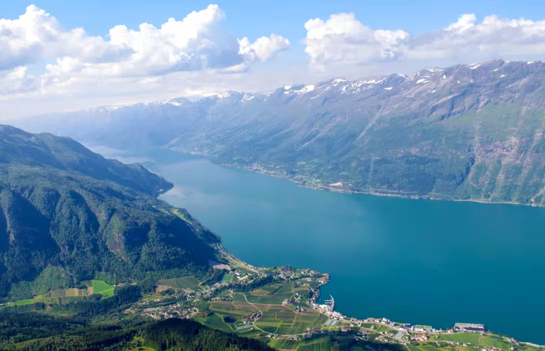
View of the Hardangerfjord from Dronningstien
The exit: two ways back to Bergen
Direct: Hardangerbrua and E16 via Voss
The trip back to Bergen will take about two hours. Cross the Hardanger Bridge north from Kinsarvik. 1,380 metres of suspension span, opened in 2013, one of the longest of its kind. Parking bays on both ends let you pull over and walk out for the view. From the Vallavik tunnel roundabout on the north side, Rv13 runs north to Voss, then E16 takes you back to Bergen. The Voss stretch is functional driving, not scenic.
Detour: Vøringsfossen and the Hardangervidda Scenic Route
Adds one to four hours depending on how deep you go.
Cross Hardangerbrua and continue east 20 minutes to Eidfjord. From there, a winding climb up through Måbødalen brings you to Vøringsfossen, a 182-metre waterfall with a stepped footbridge over the gorge opened in 2020. Go before 09:00 or after 18:00 unless you want the tour-coach experience.
Read more about Vøringsfossen and the Hardangervidda scenic route
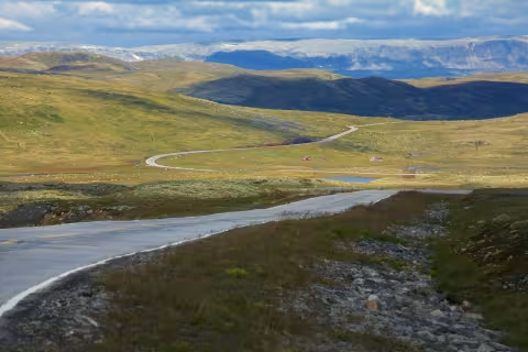
From Vøringsfossen, the Hardangervidda Scenic Route continues east across Europe's largest mountain plateau, 67km at around 1,200 metres elevation, ending at Haugastøl on the Bergensbanen railway line. Drive the full length and loop back over the top (adds about four hours), or turn back at Vøringsfossen (adds about two). The plateau road can close in winter storms, so check vegvesen.no before committing in shoulder season.
To do the full Hardangervidda route properly, consider staying a night at Geilo rather than cramming it into the return day. See the Hardangervidda Scenic Route article for the full stop-by-stop and overnight options.
Hardangervidda scenic road self-drive